A long time ago when I first envisioned this blog, I had visions of it being a sort of hiking guide for the Southeast Wisconsin area, especially tailored for beginners. I started creating these posts but they were very time consuming and honestly, not the most interesting thing to do! I realized that that many of the places I could easily write about I just hadn’t taken the right pictures I would need to visualize the story for people and that could go with all the step-by-step walk throughs I wanted to write up for true newbies so they could feel comfortable trying out hiking. I abandoned the blog and it stayed out in the ether somewhere. When I came back to it, I found that one of my posts about Devil’s Lake State Park was still really popular, so I left it up. Now, coming back to this blog I still see that that post gets between 200-400 hits per MONTH just with Google searches! I figure it must be worthwhile and maybe I should try my hand again at writing some more!
This post is about a fav, Grant Park, near my home that I walk a lot. I kept the style exactly like my Devil’s Lake one for now, but might consider adding, taking away, or changing things up as I try out these hiking guides again. I’ve LOVE feedback from you, dear reader! Let me know if this is all too much or not enough or something else, so I know how to proceed!
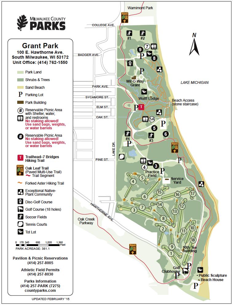
Location: Grant Park (100 Hawthorne Ave, South Milwaukee, WI 53172)
Grant Park is one of the most popular of the Milwaukee County Parks, and for very good reason! It has a lot to offer! Unlike the lakeshore parks in the downtown area, Grant Park is very wooded and natural, so it makes you feel like you aren’t in the middle of a city. It has stellar lake views from the cliffs and access to about 2 miles of walkable beach! It’s a popular spot for sunrise photography, beach days, combing for beach glass and fossils, picnicking, hiking, and lots of sports.
If you only have one day, this ~4.8 mile hike will give you the most scenic highlights of the park! It is one of my very favorite loops in the urban area!
Maps:
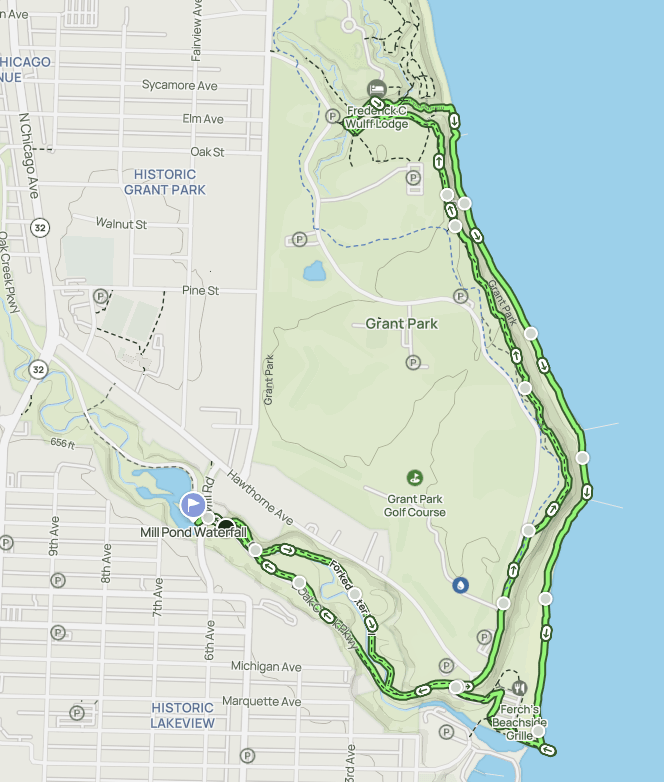
This is an AllTrails route I created of my favorite loop to do in the park! It starts outside the park at the Mill Pond, goes off onto a side trail along the Oak Creek and then connects with the Forked Aster Trail and part of the 7 Bridges Trail in Grant Park before returning along the shoreline. In winter or times of high water, you can always skip the shore and return along the same route along the cliffs. There are two parallel trails up there, one paved and one a single-dirt track, so you still get a slightly different experience even if you return cliffside!
Step by Step Guide to Hiking the Lake Loop
You can start this loop wherever you would like! There is ample parking at the Marina and at picnic area 5 up at the bluff, but I prefer to park along the road at the Mill Pond because it is quieter. So that is my start and end point for this guide.
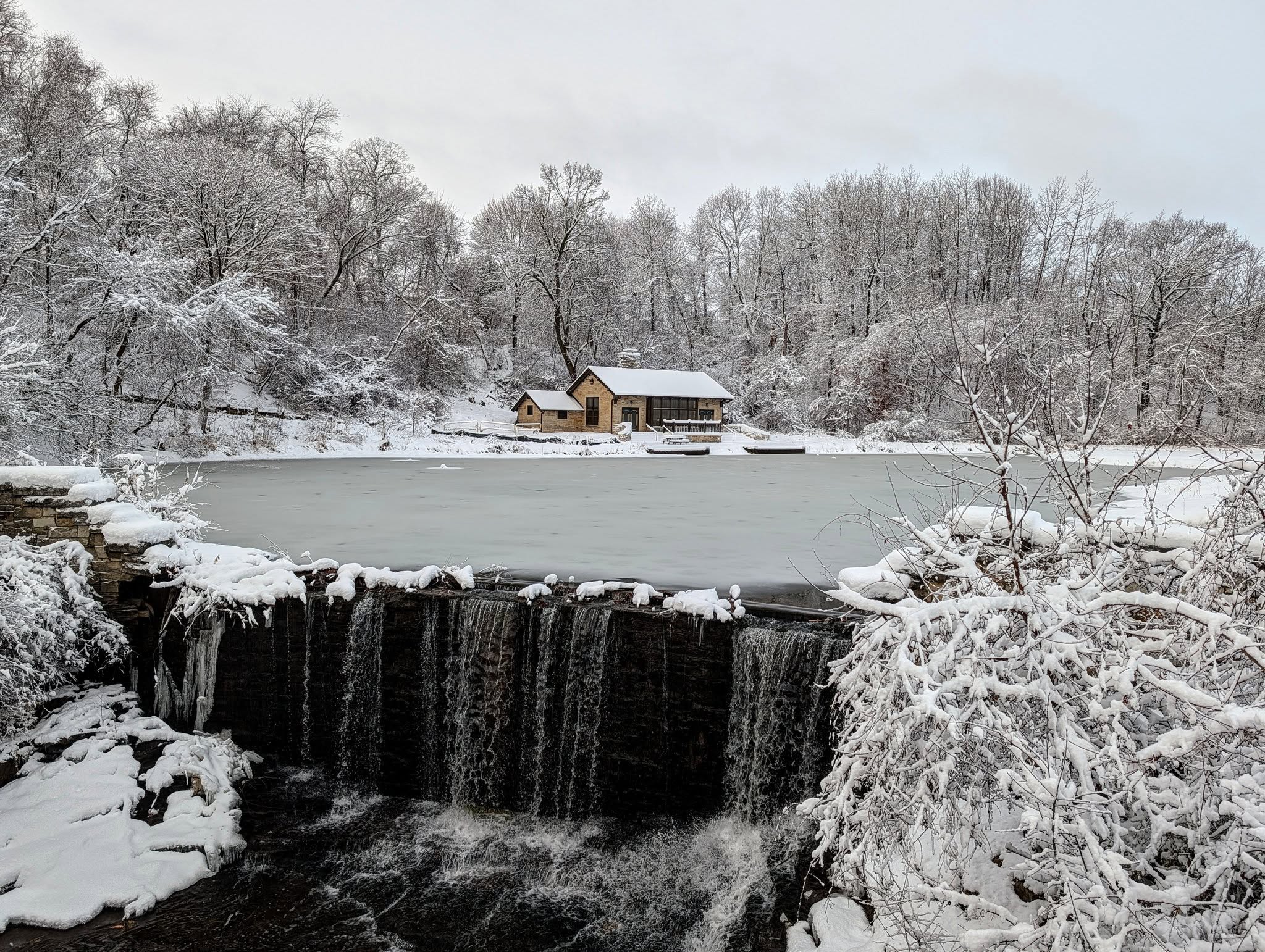
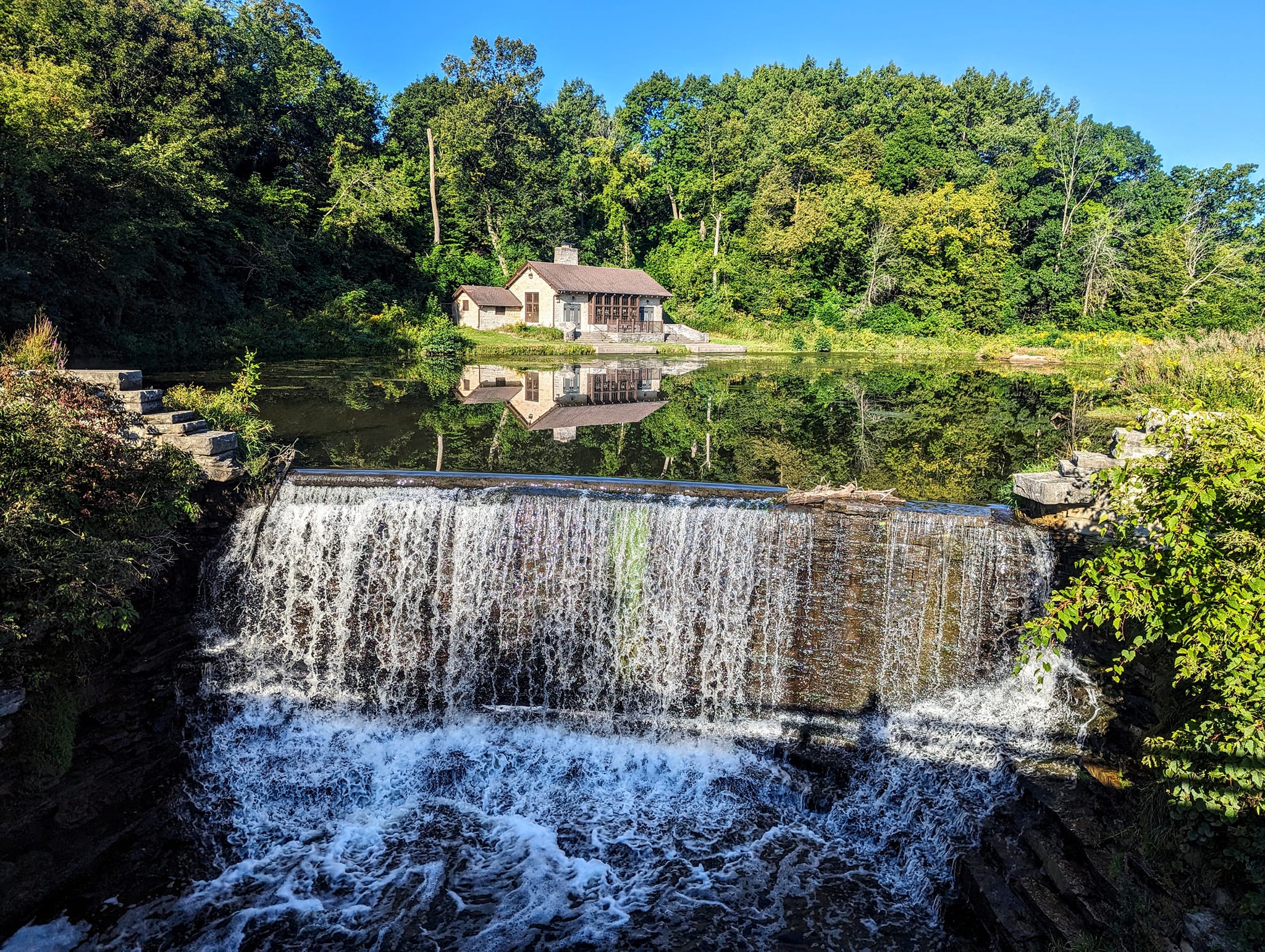
At the Mill Pond, you can park along the south side of the road, signs are pretty clear! I’ve never had any issues with vandalism, car being swiped, or theft or anything like that. There will likely be several cars already there, as the stream is a very popular fishing hole! People pull giant fish out of this little stream! You’ll immediately be able to hear the water fall if it isn’t frozen, so go check it out! There are a few viewing angles, one at the top of the road, one right from the top of the waterfall, and one from underneath the road. Do a little exploring and wandering! It’s a beautiful spot in all seasons.
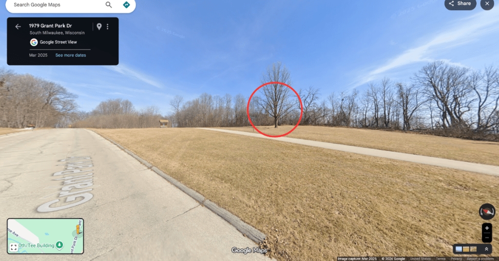
From here, you are going to head back towards your car and then cross the street! I know that it looks like there’s nothing but sidewalk, but there is actually a very secret trail that goes along the Oak Creek that is magical! To find it, notice that you are actually standing on a bridge disguised as a road. There is a concrete barrier on the north side of the road (opposite your car). To the West/left side there is a little opening in the brush. Take it! I promise! You’ll discover a little dirt path along the concrete and stream. Just keep following it! You will notice it opens up into a lovely path. I’m not even sure this is an official trail vs just the path that all the people fishing have worn in. But it is SO worth it. You leave the street behind and meander along the creek which is so tranquil.
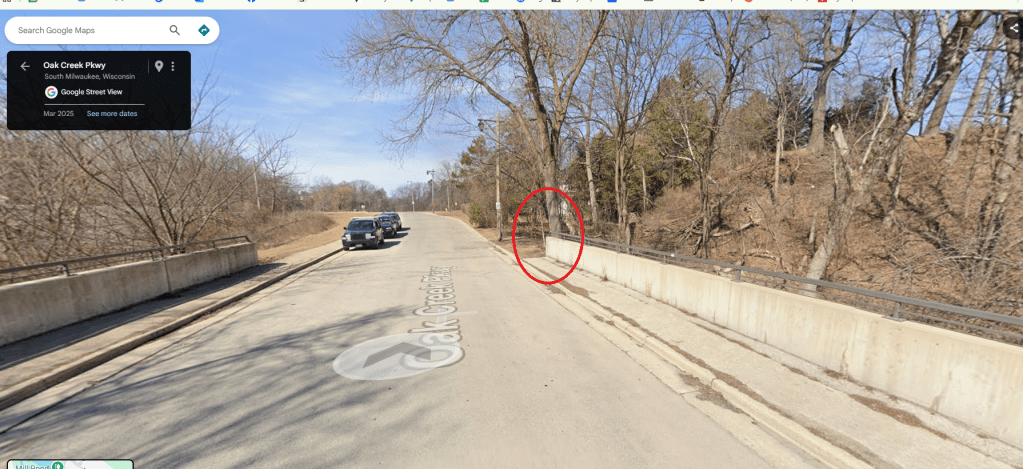
Here’s a screenshot of the road, looking West. You can see the cars parked on the South side of the street. The red circle is where the opening is for the trail!
This trail will pop you back out on the road after awhile and you will take a left and follow the sidewalk. The sidewalk will end and you will continue following the road up the hill past the golf course. When you hit a fork in the road, don’t turn! Don’t go left past the golf course building and don’t go right down to the marina. Just keep walking on the road. You’ll walk along between a tree line and the golf course parking area. Eventually you will see a paved sidewalk on your right. But, I prefer to not take that either! You totally can, but that is the paved Oak Leaf Trail and I prefer to walk the dirt Forked Aster Trail. To find that, you will look for this tree in the pic below. There is a little hidden opening in the brush again, hiding this lovely trail! If you miss it, don’t worry. You’ll physically see it at several points when on the paved one and can hop over to it!
Behind this tree will be an opening in the brush and the smallest, best camouflaged trail sign Milwaukee County could come up with to mark the Forked Aster Trail! Generally you can see in the grass where it is worn down with others people’s footsteps. I promise it is there, just walk the treeline if you don’t see it right away!
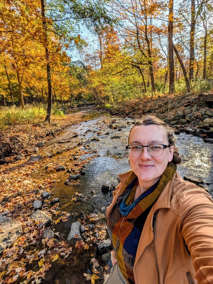
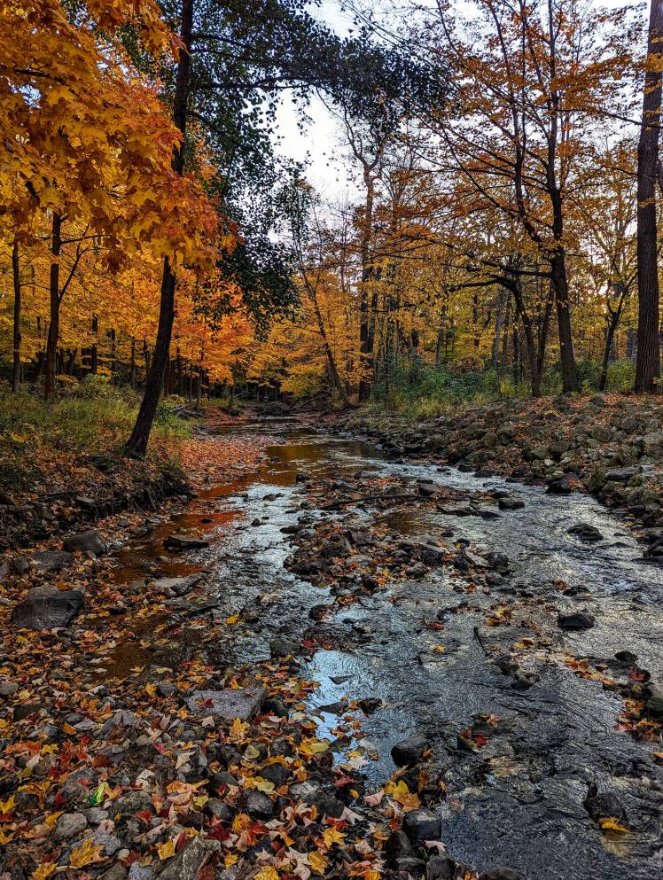
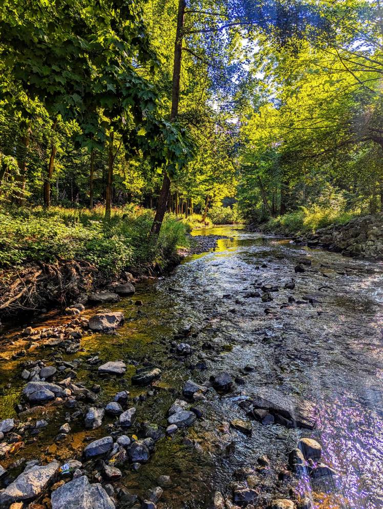
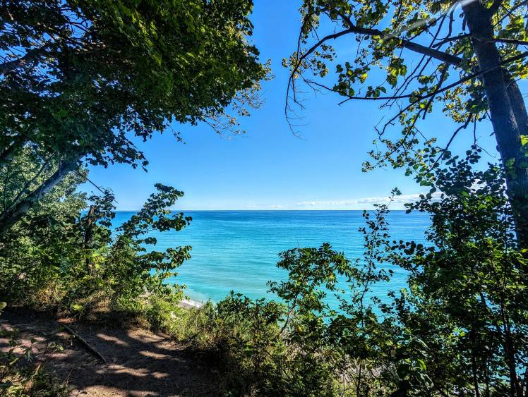
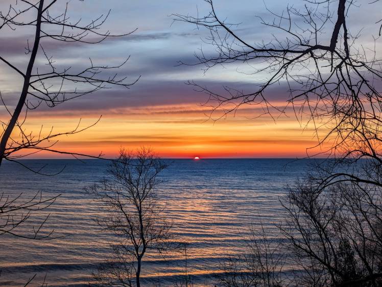
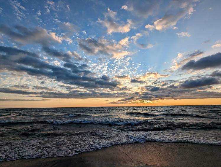
What I love about this dirt path is the incredible cliffside views of the lake! There are several spots I know really well and visit again and again to get amazing shots in different seasons, or to photograph the sunrise. You’ll start to come across more people on this part of the trail, but I find that it is never truly crowded. Check out some of my fav views from this stretch if you need some convincing to hunt for that hidden trail!


From here, the trail will pop you out at picnic area 5, you’ll see a large parking lot off to your right. I continue going straight and then do a loop through the 7 Bridges Trail system, which is the most popular area of the park. You’ll come across a lot of people hiking, running, and walking dogs on these paths on warm days and especially weekends. Personally, from May-October, I tend to avoid this area after 10am for that reason. Too people-y for this introvert!
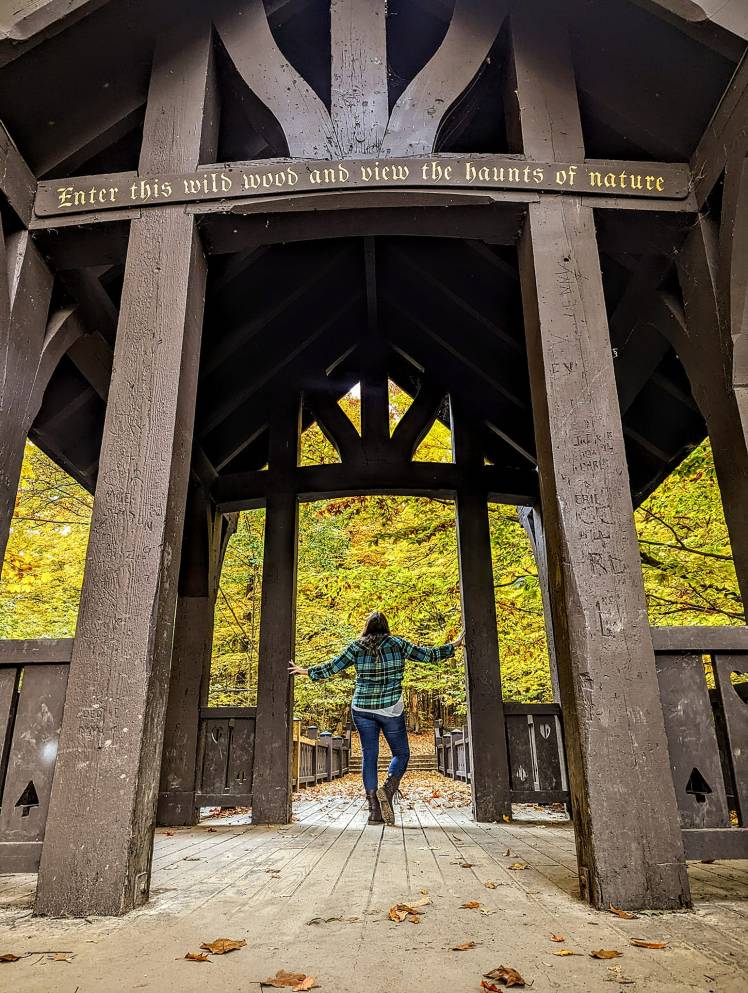
I tend to take a left when I reach the first staircase, and go through the woods so I can cross over the iconic main bridge with the “Enter this wild wood and view the haunts of nature” quote on it! Always gotta get that selfie for the Instagram feed! That’s when I then take the staircase down to the ravine. It will be just to the other side of this bridge when you cross over, cannot miss it!
This will then lead you down into the also iconic 7 bridges area (which, by the way….there are TEN bridges in this ravine trail system. Drives me batty they named it this!)
When I am doing this loop, I don’t usually diverge off the main path. I just follow the stream at the base of the ravine all the way to the lake so I can complete my loop walking along the lake to get back to the marina.
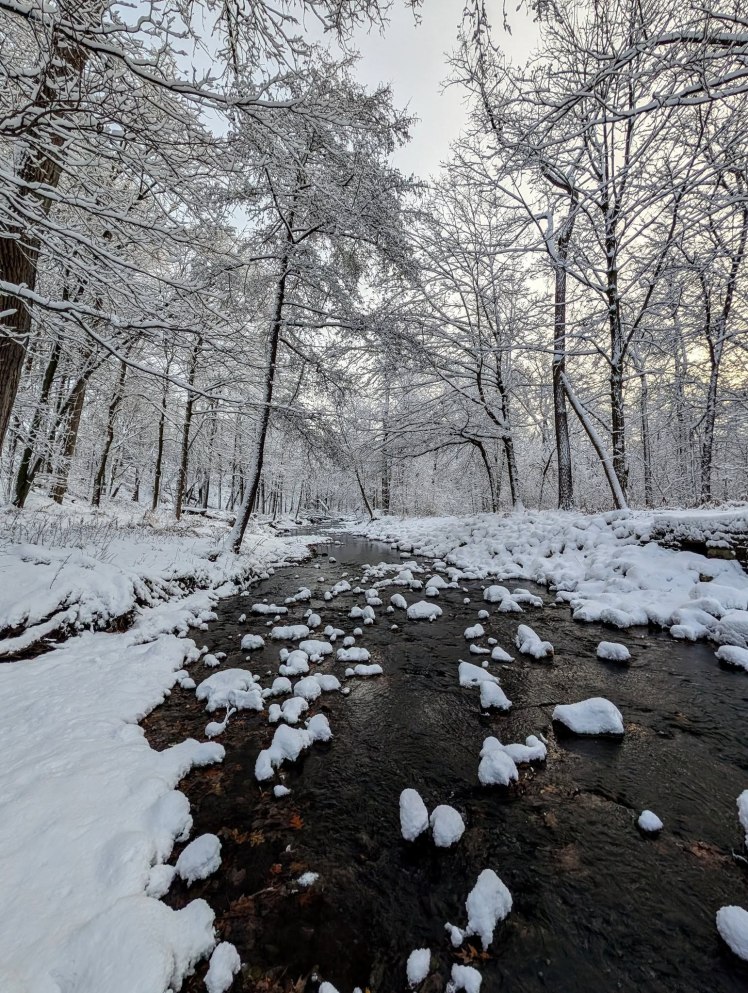
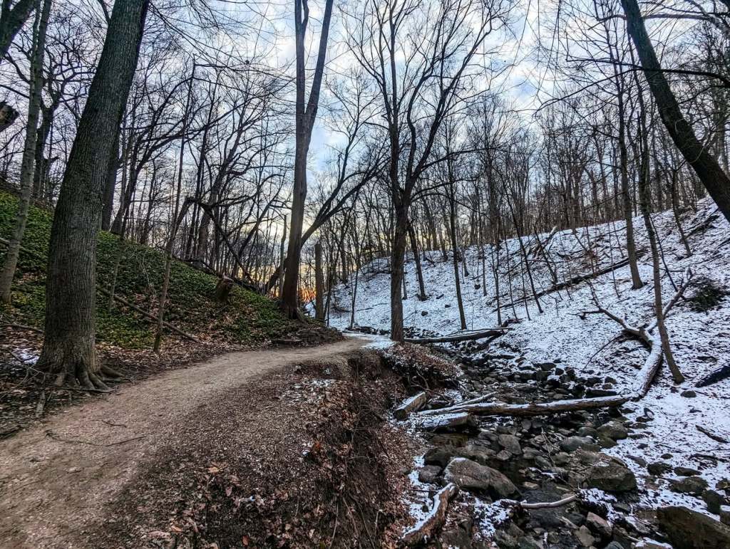
Now, I cannot express to you how absolutely COOL this ravine is! It is highly photogenic in all seasons and all weather conditions. I absolutely love coming here when it is foggy, rainy, just after the first snow, after we’ve had a lot of rain, in peak fall color season….pretty much all the time lol! It has so much character and so many cool things. It also seems to have really unique microclimate stuff going on. Take this picture for example. This was the first snow of the year in 2024 and it only accumulated on one half of the ravine! Such a unique feel walking through that day! I’m making the image GINORMOUS for this blog post because, well, LOOK AT IT!
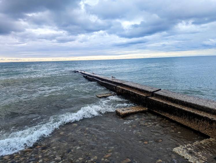
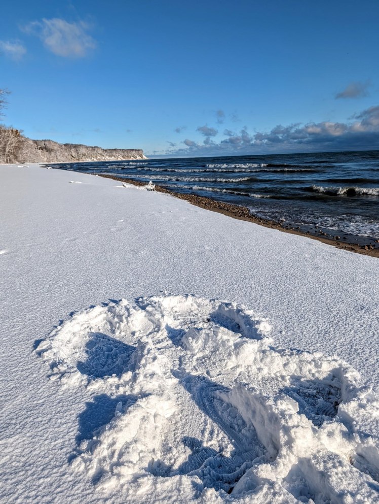
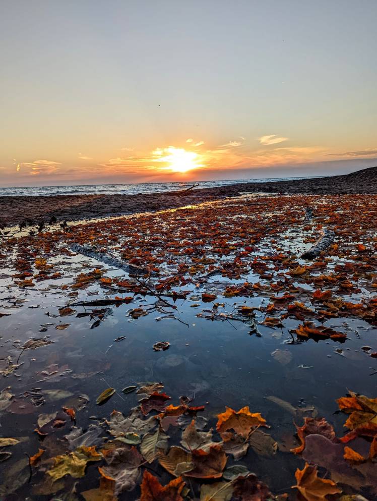
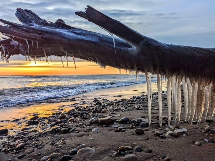
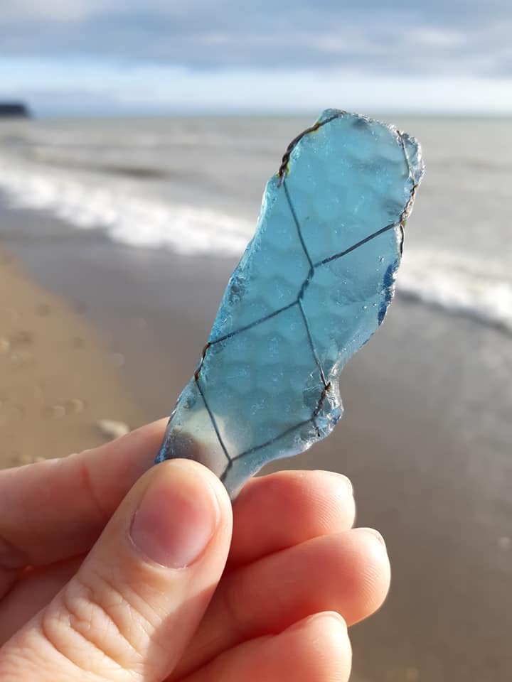
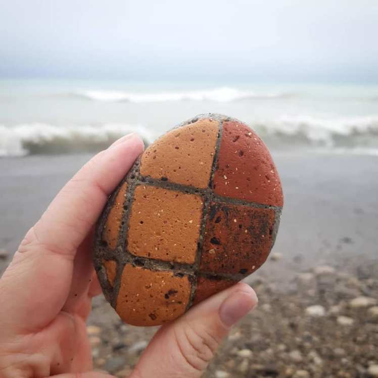
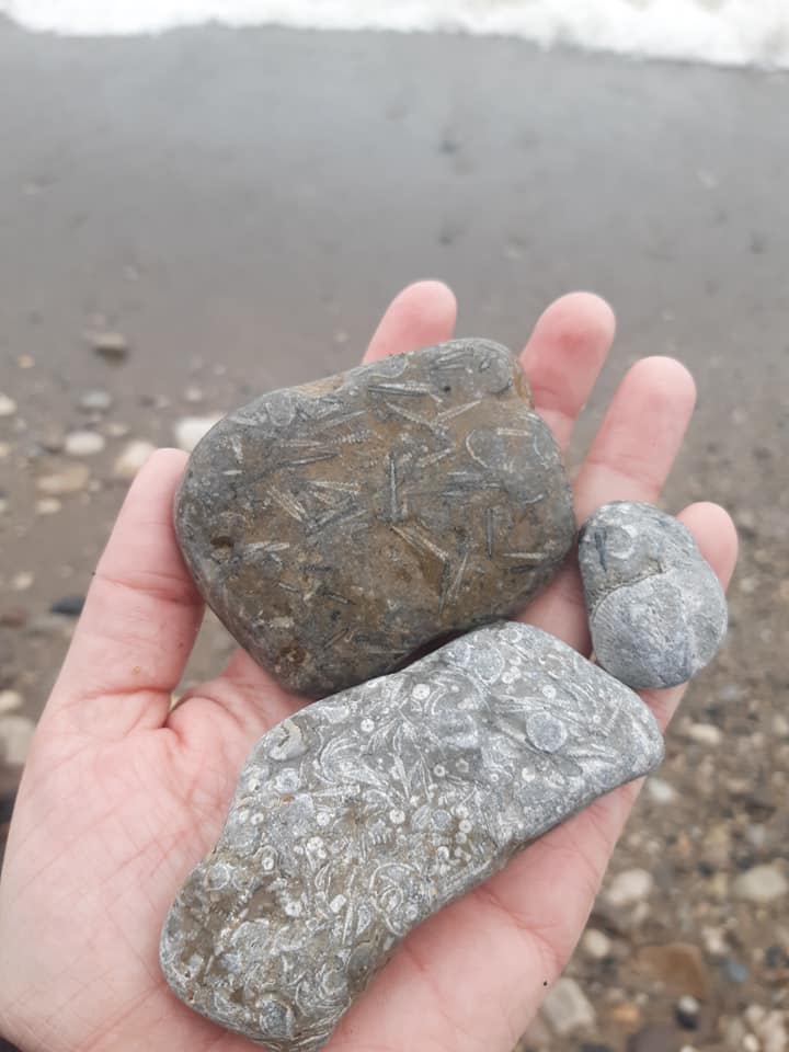
From here, you’ve reached the lakeshore and it is a very straightforward path to get back. Just keep walking south along the beach until you hit the marina and picnic area on the beach! It’s pretty far, but don’t worry, it is almost always fully passable! Some winters you can’t do it if the ice is built up and dangerous, and sometimes the water will be a little high and your feet will get wet. But that’s part of the fun! There’s always cool rocks to find and usually you can find plenty of beach glass. So allocate a good chunk of time for this hike! It may only be ~4.8 miles but you will probably spend a lot of time marveling at the lake overlooks and picking up cool things on the beach as you go.
And that’s almost a wrap! From the marina area, you will come back up to the road and take a left back down the way you came! You can go back into the woods along that same wooded trail along the creek, or just continue on down the sidewalk all the way back to your car. I usually opt for the sidewalk, because it’s something different from what I already did, plus I’m pretty pooped from all the beach combing I just did and am ready to get to my car and take off. I often swing by Better Together Cafe (see below for details) to replace all those calories I just burned, and I won’t tell anyone if you do too!
Park Amenities
There are a TON of amenities at this park, so it is impossible to name them all! Here’s a highlights list:
- Food In The Park – Ferch’s Beachside Grill: This is located at the Marina area but is only open seasonally. You can get burgers and fries, chicken tenders, hot dogs, onion rings, soft pretzels and ice cream, right on the beach!
- Food Outside the Park – Better Together Cafe: Being an urban park, there are lots of places right around it where you can go for other food. However, I feel Better Together deserves a special call-out! This locally owned coffee & ice cream shop has some amazing, unique creations! The shake of the month is always really fun with lots of toppings (sometimes such as an entire cheesecake!) and definitely worth splurging on!
- Picnic Areas & Shelters: there are tons of picnic areas here. The biggest one is at the marina again, with lots of space outside the beach house and grill with tables and benches. The second main one is at picnic area 5 which has a large shelter house with seasonal bathrooms. Picnic area 7 on the far northside of the park also has a smaller shelter house. There are several other smaller picnic areas in the park, see the map!
- Hiking & Biking Trails: In addition to the loop I outlined, there are a few other trails that run along the park, mainly north of this loop. It also connects very well to other adjacent green spaces to expand your hike, including Warnimont and Sheridan parks to the north and the Oak Creek Parkway to the west.
- Other Recreational Activities: soccer fields, tennis & pickleball courts, Grant Park Golf Course, it’s a summer beer garden location, playgrounds, and the Wil-O-Way Rental Hall Facility.
Fees
Grant Park is free to visit, park, hike, sunbath, swim, and bike! You just need to pay for renting facilities or food at Ferch’s.
Discover more from An Ordinary Odyssey
Subscribe to get the latest posts sent to your email.
